Products and Services (316 KB)
This statement is a one- page summary of ERIC's products and services in the business, resources and planning sectors.
Reference Material (180 KB)
This statement is a one-page summary of ERIC's reference papers, map products and capability statements included on the website.
Climate Products (440 KB)
This statement is a one-page summary of ERIC's capability to map climate conditions to support risk assessment and enterprise site selection.
Regional Soil Products (564 KB)
This statement is a one-page summary of ERIC's capability to map regional soil properties, including salinity, soil depth, texture and pH.
Soil Fertility Products (504 KB)
This statement is a one-page summary of ERIC's capability to map soil fertility in regions of complex geologies and to support risk assessment and enterprise site selection.
Salinity Map Products (943 KB)
This statement is a one-page summary of ERIC's capability to map soil salinity over regional, farm and paddock scales.
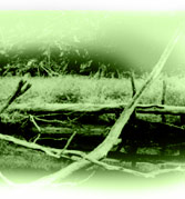
Surface Water Products (476 KB)
This statement is a one-page summary of ERIC's capability to map surface water conditions including drainage, soil moisture holding capacity, soil wetness, water features (dams, lakes, ponds, wetlands, etc.) flooding, channel leakages, etc.
Groundwater Bore Location Products (696 KB)
This statement is a one-page summary of ERIC's capability to map the location of groundwater bore sites using radiometric, magnetic, gravity, terrain (elevation), geology and land cover information. ERIC uses other field techniques to specifically site bores.
Vegetation Products (474 KB)
This statement is a one-page summary of ERIC's capability to map a wide range of vegetation and land cover features using remotely sensed data, eg. optical satellite data. This includes crop health or yield variation, fire scars and hazards, erosion, weeds and native grasslands, at regional and local scales.
Landholding Products (416 KB)
This statement is a one-page summary of ERIC's capability to map a range of land resource features at a farm or landholder scale. This includes vegetation cover and soil properties. |